The vastness of Earth’s ocean is highlighted by the fact that some parts of it are so remote that the nearest human habitation is the International Space Station. As the planet continues to warm, monitoring the ocean and understanding its changes becomes crucial for all of us. To study remote waters, scientists are turning to space.
NASA and CNES recently launched the Surface Water and Ocean Topography (SWOT) satellite, which promises to provide scientists with a better view of the ocean’s surface than ever before. This mission will reveal important information about ocean currents, which play a significant role in weather and climate patterns.
To fully utilize the satellite’s observations, it is necessary to compare them with measurements taken at the surface level. That is why a team is heading out to sea on the advanced CSIRO research vessel RV Investigator to collect essential ocean data along the satellite’s path as it orbits Earth.
Climate change is causing disruptions in the global network of ocean currents. Researchers have observed a slowdown in the deep “overturning circulation” that transports carbon, heat, oxygen, and nutrients around the world. At the same time, surface ocean currents are becoming more energetic.
Western boundary currents, such as the Gulf Stream and the East Australian Current, have also experienced significant changes. These currents transport heat from the tropics to the poles and have been warming at a rate two to three times faster than the global average in recent decades.
As these currents destabilize, they affect how heat is distributed throughout the ocean, leading to major changes in local weather patterns and marine ecosystems. These changes can have significant impacts on millions of people.
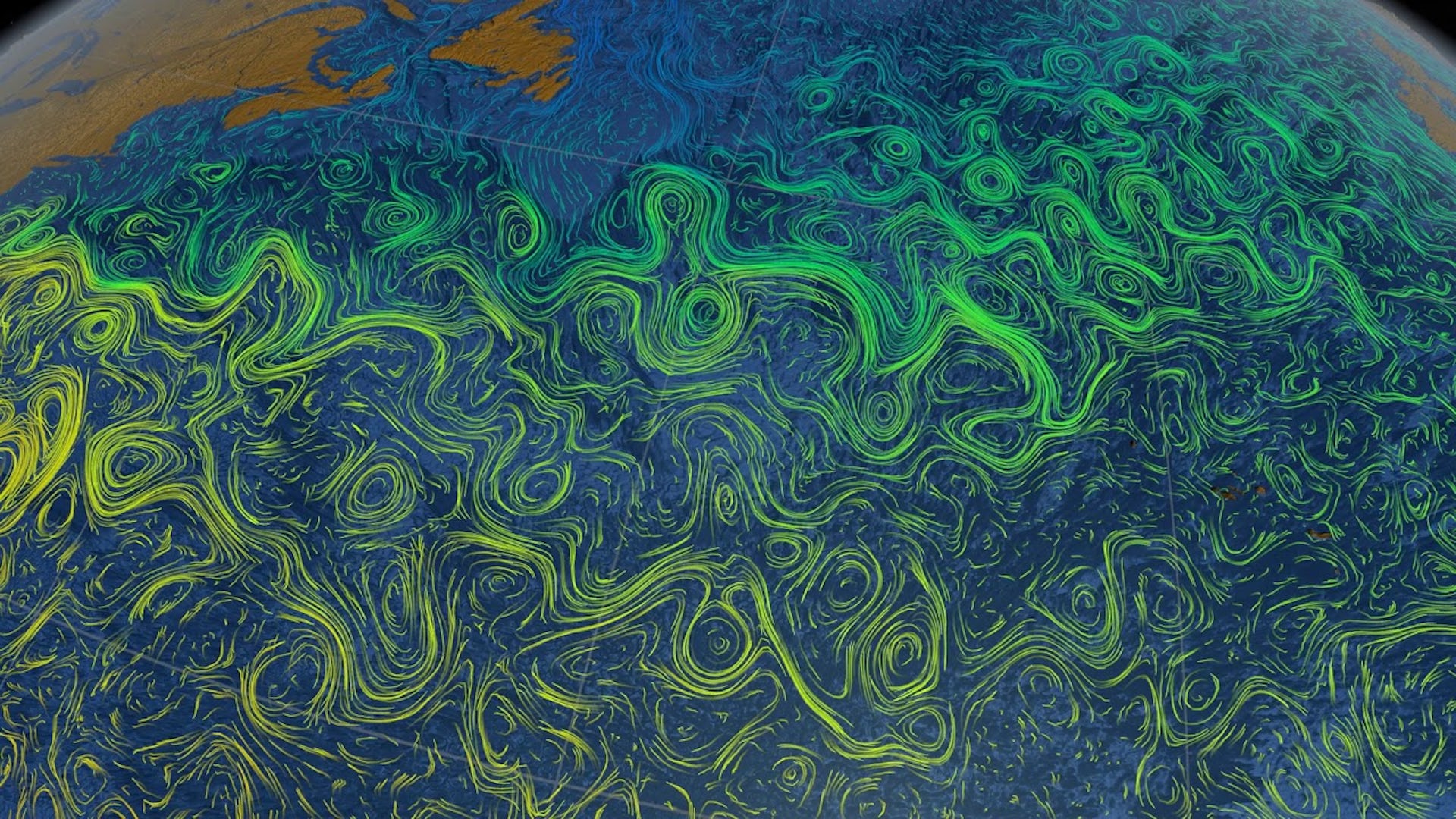
The SWOT satellite mission will provide researchers with a powerful tool to monitor changes in ocean currents by using precise satellite measurements of the sea surface. By mapping variations in sea surface height, oceanographers can estimate the currents flowing beneath. These variations in height create pressure differences that cause water to flow from areas of high sea level to areas of low sea level. The Coriolis force, which deflects currents to the right in the Northern Hemisphere and to the left in the Southern Hemisphere, balances this pressure difference.
To make sense of the satellite data, researchers need to compare it with observations made on Earth. This is why a team of scientists, support staff, and crew are embarking on a 24-day voyage aboard the RV Investigator. They will study ocean dynamics off Australia’s southeast coast using advanced scientific equipment, including satellite-tracked buoys and drifters to measure real-time current movement at the ocean surface.
This voyage is part of a global collaboration to gather observational data under the satellite’s path and validate satellite measurements. The data collected will improve weather forecasts, climate risk assessment, and prediction.
By studying the ocean from space, at sea, and even through playground physics, researchers hope to gain a better understanding of how our oceans are changing. This research is supported by a grant of sea time on RV Investigator from the CSIRO Marine National Facility.