In a recent study published in the journal Tectonophysics, my colleague Tony Yeates and I have explored what we believe to be the largest impact structure in the world. Located deep underground in southern New South Wales, the Deniliquin structure spans up to 520 kilometers in diameter, surpassing the previously considered largest impact structure, the Vredefort impact structure in South Africa.
The history of asteroid impacts on Earth is largely hidden due to erosion and other geological processes. When an asteroid strikes, it creates a crater with an uplifted core, similar to a splash in a pool. However, these central uplifted domes can erode over time, making them difficult to identify. Impact structures can also be buried by sediment or disappear due to tectonic plate movements.
Nevertheless, recent geophysical discoveries have revealed signatures of impact structures formed by asteroids that may have been tens of kilometers across. These discoveries provide new insights into Earth’s evolution over time. Some large impacts are even associated with mass extinction events, such as the asteroid strike that wiped out non-avian dinosaurs 66 million years ago.
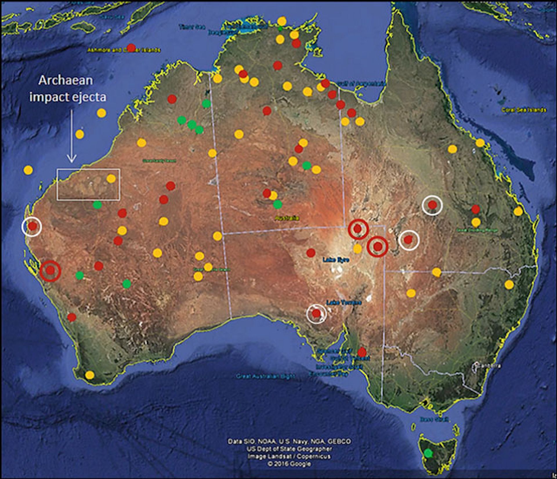
The Australian continent and its predecessor, Gondwana, have been subjected to numerous asteroid impacts. We have identified at least 38 confirmed and 43 potential impact structures in the region. When a large asteroid hits Earth, the underlying crust responds with a transient elastic rebound, creating a central dome. These domes can erode or become buried over time, leaving behind the deep-seated “root zone” of an impact.
Between 1995 and 2000, Tony Yeates proposed that magnetic patterns beneath the Murray Basin in New South Wales indicated the presence of a massive buried impact structure. Updated geophysical data from 2015 to 2020 confirmed the existence of a 520km diameter structure with a seismically defined dome at its center.
The Deniliquin structure exhibits all the characteristics expected from a large-scale impact structure. Magnetic readings reveal a symmetrical rippling pattern in the crust around the core, indicating intense magnetic forces generated during the impact. A central low magnetic zone corresponds to deep deformation above a seismically defined mantle dome. Radial faults and igneous sheets of rock, typical of large impact structures, are also present.
Currently, most of the evidence for the Deniliquin impact is based on surface geophysical data. To confirm the impact, further drilling is needed to collect physical evidence of shock. Determining the exact age of the structure will require drilling into its magnetic center and dating the extracted material.
The Deniliquin structure likely formed during the Late Ordovician period on the eastern part of the Gondwana continent. It may have been associated with the Hirnantian glaciation stage, a major mass extinction event that eliminated 85% of species on Earth. However, it is also possible that the structure predates this event and originated in the early Cambrian period.
Further studies of the Deniliquin impact structure have the potential to provide valuable insights into Earth’s early Paleozoic history.