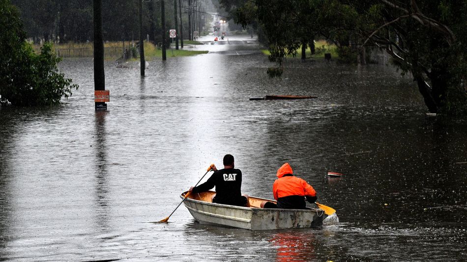
Less than 18 months after the “Black Summer” bushfire crisis that made global headlines last southern summer, Australia’s east coast is dealing with torrential rain and flooding described as a “once-in-100-year” event — with many of the affected communities the very same ones still recovering from the one-two punch of the fires and the pandemic.
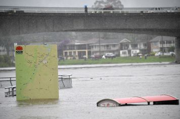
A flooded park along the overflowing Nepean river in Penrith suburb on March 21, 2021. The red covers are the tops of large garbage bins.
Image: SAEED KHAN / AFP / Getty Images
A clashing combination of three separate weather systems brought a downpour to a huge area from March 18 onward, spanning the most populous state of New South Wales, Queensland to its north, Victoria to its south, and the Australian Capital Territory inland to Sydney’s southwest. At certain points the national Bureau of Meteorology had issued official severe weather warnings across an area roughly the size of Alaska, affecting over 10 million people. Sydney’s main water supply, the Warragamba Dam, had its first major overspill in more than 30 years, with 500 gigalitres per day at the spill’s peak — Read more…
More about Australia, Extreme Weather, Science, and Climate Environment